Model your site in 3D
Generate accurate, georeferenced site context models, ready to drop into your CAD or BIM workflow.
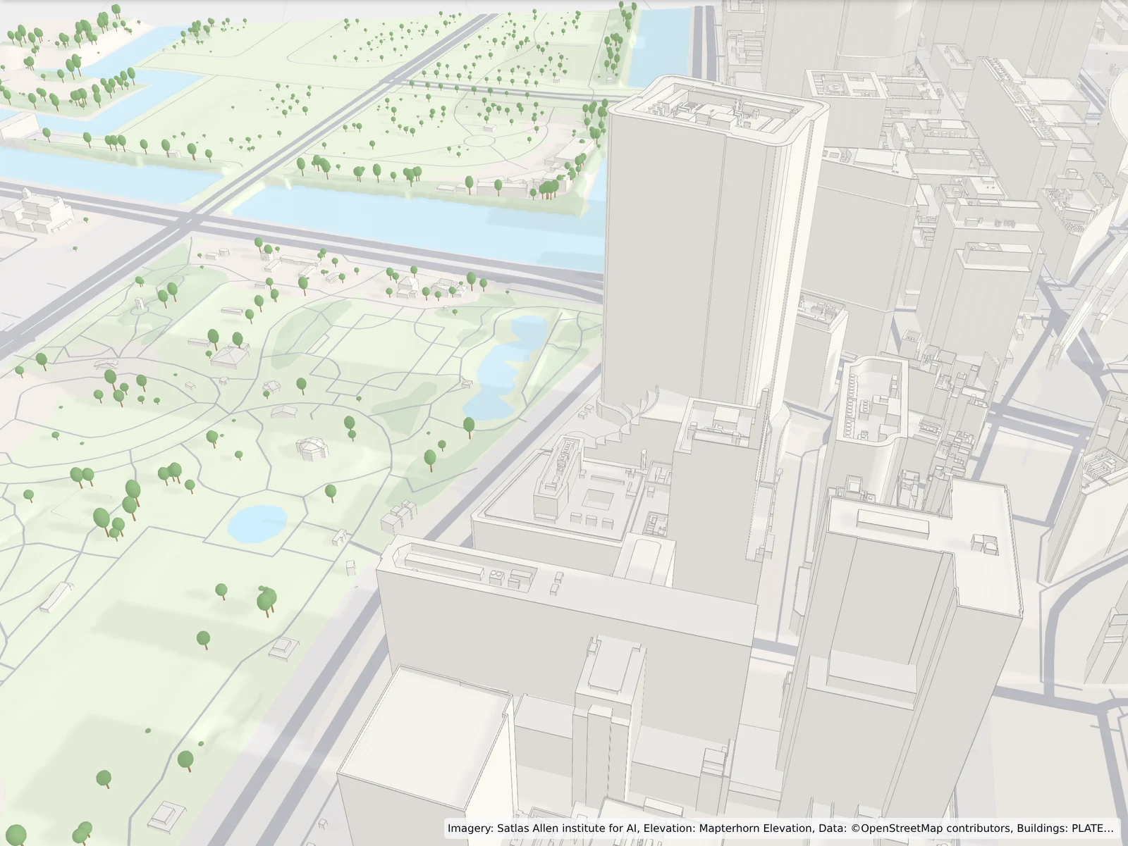
Export to any format you need
One georeferenced model, exported in the format your tools expect.
Works with your tools. Opens directly in Revit, ArchiCAD, AutoCAD, Rhino, SketchUp, Blender and more.
 .glTF
.glTF .obj
.obj .3mf
.3mf .stl
.stl .dxf
.dxf .3dm
.3dm .skp
.skp .ifc
.ifc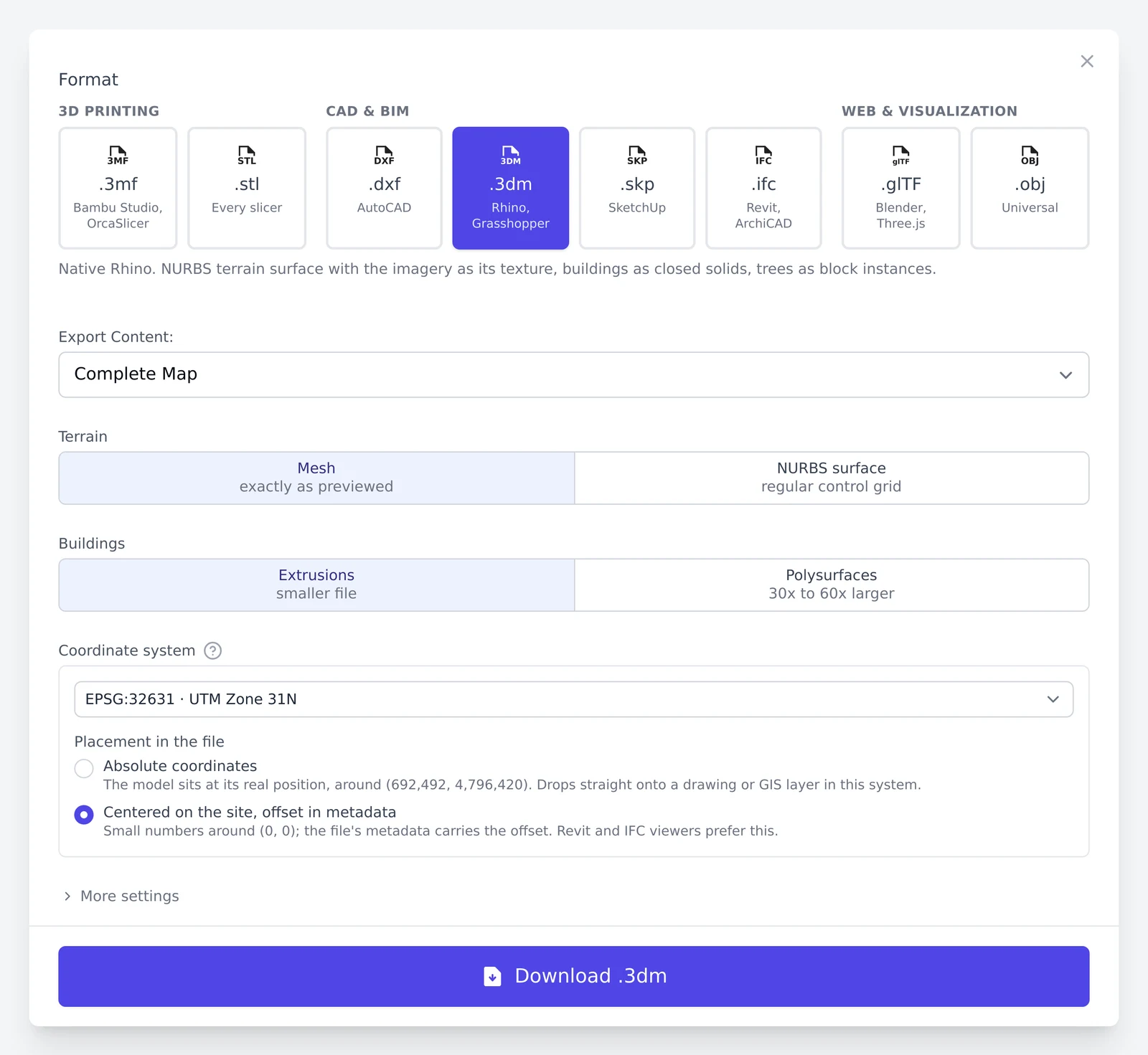
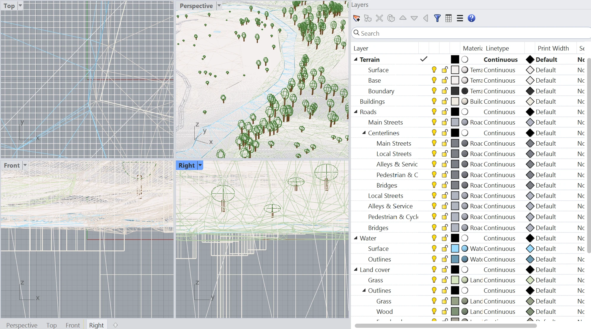
Every feature on its own layer
Show, hide or edit each one independently, in your viewer or CAD tool.
Terrain, buildings, roads, water, land cover and trees, each on its own layer, with sub-layers for centerlines, outlines and the terrain base. Where the format supports it they arrive as real CAD geometry rather than meshes: the terrain a NURBS surface, buildings closed solids, outlines and centerlines curves, trees block instances.
Coordinate systems
Every real-size export carries its real-world position and true north, in the coordinate system you pick. Included in every export.
- UTM by default
- The site's UTM zone is picked for you. State Plane zones, national grids and 260+ other systems are one search away.
- Grid coordinates or a local origin
- Absolute grid coordinates in the file, or geometry near the origin with the position stored in the file's own anchor.
- True scale
- A 20 m building measures 20 m. No Mercator stretch, no correction factor.
High-detail buildings from national surveys
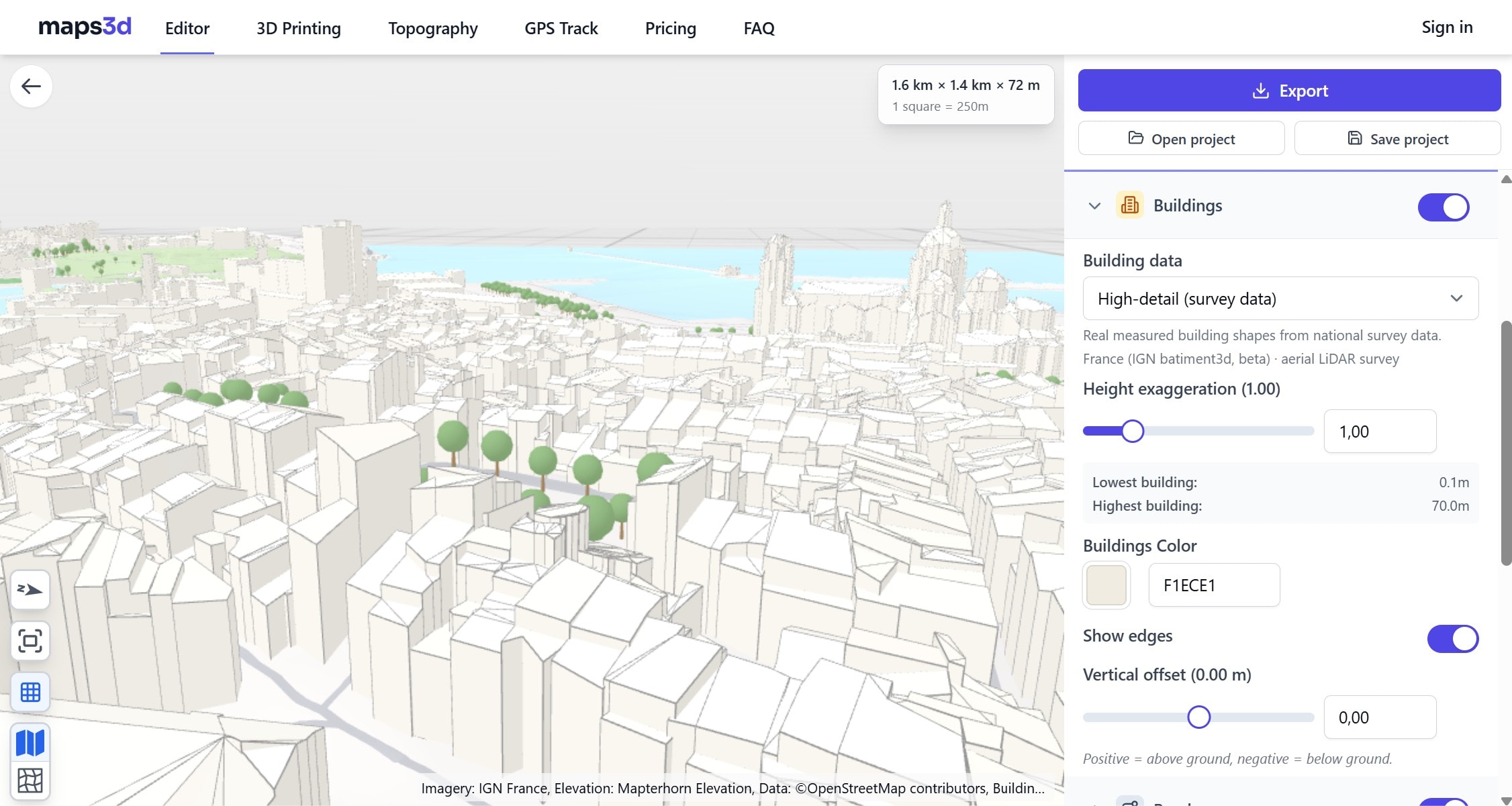
In covered areas, switch the buildings layer to high-detail: real measured roof shapes and volumes captured by national mapping agencies with aerial LiDAR and photogrammetry, instead of extruded footprints.
Current coverage:
- JapanPLATEAU (MLIT)300 municipalitiesaerial LiDAR and photogrammetry
- SwitzerlandswissBUILDINGS3D (swisstopo)aerial photogrammetry
- Germanybasemap.de (BKG)aerial LiDAR survey
- Netherlands3DBAGaerial LiDAR survey
- LuxembourgBD-L-BATI3D (ACT)aerial photogrammetry
- Francebatiment3d (IGN)aerial LiDAR surveybeta
Coverage grows as national agencies publish new open data.
The best open data for every area
- Elevation
- Up to a 1 m grid
In parts of the country
Sources: 1 meter Digital Elevation Models (DEMs) - USGS National Map 3DEP Downloadable Data Collection · USGS 3DEP 1/9 arc-second DEM +3 more
- Buildings & features
- Footprints and heights
Worldwide dataset
Sources: Overture Maps buildings
- Aerial imagery
- Up to 60 cm/px
In Contiguous United States
Sources: USA NAIP (Planetary Computer mosaic) · USA National Agriculture Imagery Program (WMS Backup)
- Parcels
- Cadastral parcels
In 29 regions
Sources: Alaska (Statewide Parcels) · Arkansas (Planning Cadastre) +27 more
Maps3D picks the finest sources available for your selection.
Simple, transparent pricing
Flat rate or subscription. The price does not depend on the area or km² you export.
One-off purchase
No subscription, No account needed
…
- No subscription
- No account needed
- Get a link to download the same area again with different settings
- Unrestricted use (private or commercial)
- .glTF, .obj, .3mf, .stl, .dxf, .3dm, .skp, .ifcAll formats included. Opens in Blender, Bambu Studio, AutoCAD, Rhino, SketchUp, Revit and more.
- Georeferenced in your coordinate system: UTM, national grids, State Plane (260+ systems)
- VAT invoice
Subscription
Unlimited maps exports, cancel your plan when you want
…
- Unlimited maps exports
- No lock-in, you own the data and can cancel your plan when you like
- Unrestricted use (private or commercial)
- .glTF, .obj, .3mf, .stl, .dxf, .3dm, .skp, .ifcAll formats included. Opens in Blender, Bambu Studio, AutoCAD, Rhino, SketchUp, Revit and more.
- Georeferenced in your coordinate system: UTM, national grids, State Plane (260+ systems)
- VAT invoice
Frequently asked questions
- Are the models georeferenced? What coordinate system do they use?
- Yes. Every model is georeferenced and oriented to true north, so it imports at the correct real-world location in your CAD or BIM software. Pick the coordinate system at export: your local UTM zone by default, US State Plane, or a national grid such as Lambert-93, British National Grid or Swiss LV95.
- How accurate is the data?
- Models are built from open data: national LiDAR elevation on grids down to 25 cm where it exists and 30 m worldwide otherwise, aerial imagery down to 8 cm per pixel, buildings from measured LOD2 models or footprints with heights. What applies to your area depends on the country and region. They're ready-to-use context and site models, not a substitute for a measured land survey. View data sources →
- How is it priced? Am I billed by area or km²?
- No. You pay one flat price per map, whatever the area. There's no per-km² metering and no subscription required, though an unlimited monthly plan is available if you export often.
- Which formats and software are supported?
- Every export includes .glTF (Blender, Three.js), .obj (Blender, Cinema 4D and most 3D software), .3mf (Bambu Studio, OrcaSlicer), .stl (every slicer), .dxf (AutoCAD and any CAD tool), .3dm (Rhino, Grasshopper), .skp (SketchUp), .ifc (Revit, ArchiCAD). Models work offline once downloaded.
- Can I use the models commercially?
- Yes. Commercial use is included. The underlying imagery sources are open data; most require an attribution credit when you reuse the model. View data sources →